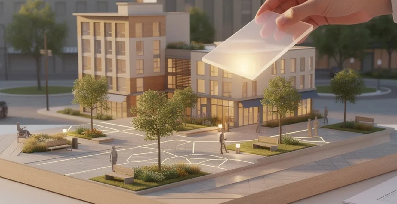
Every successful public space asks the same question of its designer: should it look good, or should it work well? The most enduring urban environments prove that this is a false choice. A well-designed street or plaza can move people efficiently, support biodiversity, encourage social contact and still be beautiful to look at. Achieving this balance requires drawing on decades of urban design theory, careful material choices, community input and a willingness to test ideas before committing to permanent change. This article examines the principles, case studies and practical techniques that planners and designers use to reconcile aesthetics with function, from wayfinding theory and human-scale design to the materials and sustainability metrics that determine whether a public space will still be loved in twenty years’ time.
Urban design principles shaping contemporary public spaces
Urban design sits at the intersection of architecture, landscape architecture and planning, shaping the physical form of the spaces where people gather, move and interact. A number of foundational theories continue to guide how designers approach the layout, scale and character of public realms today.
Kevin lynch’s image of the city and wayfinding strategies
Legible cities help people build a clear mental map of their surroundings, using recognisable landmarks, distinct districts, well-defined edges, connecting paths and meaningful nodes. When these elements are arranged with intention, pedestrians can navigate intuitively rather than relying solely on signage. This principle underpins effective wayfinding design: a well-placed landmark or a consistent street pattern can do more to orient a visitor than any map or sign, and it also contributes to a sense of place and identity that residents come to value.
Jan gehl’s Human-Scale design philosophy
The idea that cities should be designed for people rather than cars has become one of the most influential principles in contemporary urban design. This human-scale approach prioritises comfortable proportions, active ground-floor frontages, slower traffic speeds and generous pedestrian space. It draws on the same critique of modernist, car-oriented planning that Jane Jacobs articulated in her seminal work on diverse, walkable neighbourhoods, where mixed-use streets and pedestrian-friendly design foster genuine community life rather than isolated, single-function zones.
Mixed-use zoning and the 15-minute city concept
Mixed-use zoning combines residential, commercial, recreational and institutional functions within the same area, creating neighbourhoods that remain active throughout the day rather than emptying out after office hours. This principle has evolved into the 15-minute city model, which aims to place all the essential amenities a resident needs within a short walk or cycle of home. Importantly, the underlying intent extends beyond convenience: the goal is not simply to minimise travel time between indoor destinations, but to ensure the journey itself is enjoyable, offering opportunities to exercise, socialise, experience nature and feel the sunshine along the way.
Biophilic design integration in streetscapes
Biophilic design recognises humanity’s innate connection to the natural world and seeks to weave that connection into the built environment. In streetscapes, this can mean incorporating street trees, planted verges, green walls, water features and natural materials such as timber and stone. Beyond softening the appearance of a district, biophilic elements reduce stress, improve air quality, help mitigate noise pollution and encourage a slower, more relaxed pace of movement through public space.
Balancing pedestrian flow with aesthetic landscaping
Landscaping decisions must accommodate how people actually move through a space, not merely how a plan looks on paper. Getting this balance wrong results in trampled lawns, underused plazas or bottlenecks at busy junctions.
Desire lines and organic pathway planning
Desire lines are the informal paths people create when the designed route does not match their natural movement patterns. Rather than fighting these tendencies, effective planning observes where people actually want to walk and designs pathways accordingly. This approach respects the intuitive, often unpredictable ways communities use space, echoed in the observation that public spaces which appear, on paper, to lack conventional appeal can still thrive if they genuinely serve the movement and gathering habits of local residents.
Hardscape versus softscape ratio optimisation
The balance between hard surfaces (paving, plazas, seating areas) and soft landscaping (planting, lawns, trees) determines both the functional capacity of a space and its visual character. A plaza dominated entirely by hard paving may handle high foot traffic and events but feel stark and uninviting; one with too much planting may struggle to accommodate crowds or markets. Getting this ratio right typically means matching hardscape to anticipated pedestrian volume and event use, while reserving softscape for edges, transition zones and areas where people linger rather than pass through.
Street furniture placement without obstructing circulation
Benches, bins, lighting columns and signage all need a place, but poorly positioned furniture can create pinch points that disrupt pedestrian flow. Furniture works best when placed along the edges of a route, clustered near nodes such as transit stops or plaza entrances, and spaced to avoid narrowing the primary circulation corridor. Well-planned lighting, comfortable and accessible furnishings, and the presence of greenery all combine to make a place more welcoming and to encourage the kind of social engagement that gives public space its purpose.
Case studies in functional and visually cohesive urban renewal
Examining real-world projects shows how the principles above translate into practice, and how different cities have resolved the tension between beauty and utility in their own contexts.
Copenhagen’s superkilen park and cultural zoning
Copenhagen’s approach to public space has long prioritised the pedestrian and cyclist experience over vehicular convenience, reflecting the human-scale philosophy that has shaped much of the city’s recent urban renewal. Cultural zoning within shared public parks allows different community groups and activities to coexist within a single site, with distinct areas dedicated to specific uses while remaining connected by a continuous, walkable network.
Barcelona’s superblocks (superilles) model
Barcelona’s superblock model reorganises groups of city blocks so that through-traffic is diverted to the perimeter, freeing the interior streets for pedestrians, cyclists and community activity. This reflects a broader principle seen in cities such as Bogotá, where deliberate restrictions on car use, expanded green space and pedestrianised streets have helped bridge social divides and reduce crime, while giving residents safe, healthy outdoor space close to home.
New york’s high line adaptive reuse project
Adaptive reuse transforms redundant infrastructure into new public amenities without erasing their history. Converting disused urban structures into elevated parks or linear greenways demonstrates how industrial remnants can become valued civic assets, adding green space and recreational value to dense city environments while preserving a physical link to a neighbourhood’s past, in much the same way that identifying and retaining buildings of historical and cultural value strengthens a district’s sense of identity.
Singapore’s gardens by the bay integration
Large-scale biophilic infrastructure, integrating extensive planting, water management and recreational facilities into a single cohesive landscape, illustrates how ecological function and visual spectacle can reinforce one another. Such projects support urban biodiversity, provide cooling and stormwater benefits, and create the kind of distinctive, memorable public space that becomes a source of civic pride.
Materials and infrastructure for durable, attractive public realms
The technical choices beneath the surface of a public space, its paving, drainage and lighting systems, determine how well it performs over decades and how safely it can be used after dark.
Permeable paving systems for sustainable drainage
Sustainable urban drainage systems manage stormwater effectively, reducing flood risk and improving water quality across a site. Permeable paving allows rainwater to infiltrate the ground rather than overwhelming municipal drainage networks, working alongside rain gardens and other green infrastructure to mitigate flooding during heavy rainfall while supporting healthier soil and planting.
Selecting Climate-Resilient urban materials
Materials used in public realm projects must withstand extreme weather events, including heatwaves, heavy rain and storms, without degrading quickly or requiring constant repair. Climate-resilient planning also involves designing buffer zones against flooding and sea-level rise, and choosing surfaces and structures that help mitigate the urban heat island effect rather than intensifying it.
Lighting design for safety and nocturnal aesthetics
Lighting influences both how safe a space feels and how it is perceived after dark. Poorly lit areas with heavy shadow can heighten anxiety, particularly around busy junctions, crowds or areas with a lot of noise and visual stimulation, whereas thoughtfully designed lighting schemes can transform the atmosphere of a plaza or street, making it feel inviting rather than threatening while highlighting architectural or landscape features for visual interest.
Community engagement and participatory planning frameworks
No amount of technical expertise substitutes for understanding how the people who will actually use a space want to live in it. Participatory frameworks help planners test ideas, gather feedback and build the sense of ownership that determines whether a project succeeds long after it opens.
Placemaking workshops and charrette methodology
Placemaking treats a public space strategy as more than a physical layout; it is about identifying the talents and resources within a community, including people who can offer historical perspective and insight into what genuinely matters to local residents. Workshops that bring together residents, designers and officials to explore design solutions collaboratively, as seen in projects that transformed neglected squares and markets by directly asking traders and residents what they needed, tend to produce results that are used and cared for long after the initial investment.
Digital twin technology for stakeholder visualisation
Advances in smart city technology allow planners to model proposed public spaces digitally before construction begins, using data and sensors to simulate how a design might perform under different conditions. This kind of visualisation, combined with tools such as GIS analysis of ecology, topography, climate and population, helps stakeholders understand a proposal’s likely impact and gives communities a clearer basis for feedback than static plans alone.
Tactical urbanism pilots as Low-Risk testing tools
Public spaces are organic and rarely get everything right the first time; the most resilient ones evolve through short-term, low-cost interventions that can be tested and refined over time. Seating, temporary markets, painted crosswalks, pop-up cafés and community events are all examples of « lighter, quicker, cheaper » changes that let planners gauge demand and generate momentum before committing to permanent, capital-intensive works.
Sustainability metrics in modern urban space planning
As cities face mounting pressure from climate change and rapid urbanisation, measurable sustainability outcomes have become as central to public space planning as aesthetics or circulation.
Urban heat island mitigation through green infrastructure
Green spaces, urban forests and green roofs all help counter the urban heat island effect, in which dense concentrations of hard surfaces and buildings trap and radiate heat. Trees and vegetation provide direct cooling during heatwaves, while permeable surfaces and rain gardens simultaneously help manage stormwater, making green infrastructure one of the most effective tools for addressing multiple climate risks within a single intervention.
LEED for cities and BREEAM communities certification
Certification frameworks that assess sustainability at a district or city scale encourage planners to think beyond individual buildings and consider the cumulative environmental performance of streets, public spaces and infrastructure together. This broader view aligns with the argument that regulatory and policy frameworks need updating, including zoning laws and building codes, to properly accommodate green infrastructure, urban agriculture and other nature-based interventions that certification schemes typically reward.
Biodiversity corridors within dense urban fabric
Wildlife corridors, such as greenways, riverside paths and interconnected parks, allow animals to move safely between habitats within a city, supporting biodiversity and ecological resilience even in highly built-up areas. Incorporating native vegetation and reducing barriers such as roads and buildings strengthens these corridors, while also delivering pollination, carbon sequestration and soil stabilisation benefits that reinforce the wider ecological function of the urban landscape.